Critical infrastructure. Monitored from space.
Omniterra Pulse turns satellite ground movement data into clear inspection priorities, with the evidence behind every finding.
Benefits
Portfolio-wide visibility. Focused fieldwork.
By combining satellite data with automated analysis, Omniterra Pulse is designed to make recurring monitoring economical across your portfolio. Observe more locations and focus fieldwork where closer inspection is needed.
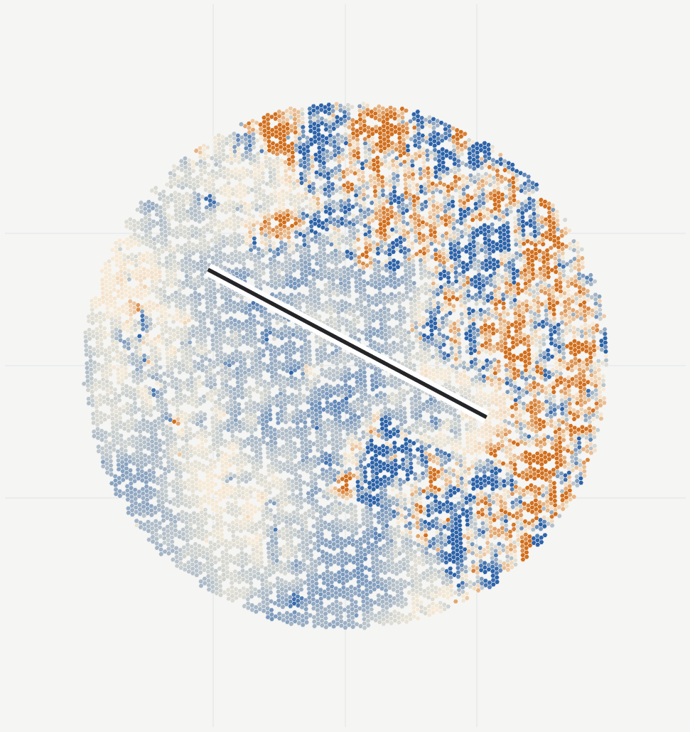
SFO · Sample movement map
Runway 10L/28R
- A movement history for your infrastructure
- Review long-term rates, recent displacement and changes in movement rate. Trace the history to individual satellite observation dates.
- Compare assets with nearby ground
- Compare movement across supported runway sections, aprons and nearby ground. See which areas warrant a closer field check.
- See movement in context
- Compare movement with rainfall, temperature and soil moisture. Use Sentinel-2 imagery to check for water, vegetation changes and nearby groundworks.
- Evidence behind every finding
- Inspect coverage, time-series consistency and data gaps. Each finding retains its source observations and processing history.
Capabilities
InSAR ground motion monitoring for critical infrastructure.
InSAR uses repeated satellite radar observations to measure ground movement over time. Pulse turns a historical baseline and new observations into inspection priorities for your sites and routes.
Compare supported asset observations with nearby ground, temperature and seasonal patterns. Use Sentinel-2 imagery to review changes in vegetation, water and exposed soil alongside the radar measurements.
Full Pulse capabilities- History
- Compare recent observations with the longer movement history around each asset.
- Asset movement
- Compare movement across buildings, facilities and route sections, and against nearby ground where observations support it.
- Field checks
- Use a shortlist of locations and the evidence behind each finding to plan field inspections.
- Ongoing updates
- Follow new observations against the baseline and revisit priorities after an inspection or repair.
- Source observations
- Check source observations, dates, methods and measurement quality.
- Review history
- Return to previous findings and report versions.
- GIS exports
- Use the measurements in your existing engineering tools.
- AI integrations
- API and MCP access is available for your engineering software and AI tools, with findings linked to their sources.
Applications
Across your sites and routes.
Before the next survey
Ports, terminals and storage
Compare settlement across quays, yards and tanks to focus the survey area.
During aftercare
Landfills and remediation sites
Follow settlement around caps, slopes and drainage between field visits.
When planning route inspections
Railways, pipelines and utilities
Find sections where changing movement calls for a ground or drainage check.
Before pavement and ground surveys
Airports and airfields
Compare movement along runways, taxiways and surrounding ground to target closer checks.
Before ground and drainage checks
Data centres and major facilities
Review movement around buildings, utility routes and surrounding ground to focus the next investigation.
At inventory close
Quarries and stockpiles
Use Atlas to turn drone surveys into stockpile volumes and compare quantities between captures.
Start with your site.
Send us a map link or a list of sites. We’ll check satellite coverage and propose a monitoring plan with a historical baseline, agreed outputs, reporting schedule and pricing.